
Philadelphia: The Vernacular to the Spectacular
An Illustrated Field Trip of the City of Brotherly Love (PAS:APAL 2012 Meeting)
Wayne Brew, Montgomery County Community College
Note: This article is accompanied by wonderful photographs. Because there are so many, we decided to make them viewable right at the point they are mentioned in the article. Each time you encounter a reference to a figure, click on the reference, and a window will pop out with a large photo and a caption. Enjoy!
Physical Setting
Over 250 million years ago a great super-slow-motion collision took place when Africa and North America came together to form part of a large super-continent called Pangaea. This resulted in mountain building and the remnants are the ancient uplifts of the Appalachians. In the Philadelphia region the collision altered the rocks with pressure and heat creating metamorphic rocks. Many structures in Philadelphia are built with the most common of these rocks called the Wissahickon Schist, which is characterized by its shiny (mica) striations. Another useful rock found in the region is a thin band of limestone which creates excellent soil conditions for farming. Further west the limestone underlies large areas in Lancaster County. These rock formations create the foothills of the Appalachians and are referred to as the piedmont. To the east, these formations are buried under sediments deposited from the weathering and erosion of these rocks from the north and west creating the coastal plain. This change in topography is referred to as the Fall Line; it is delineated by the first rapids on the rivers stretching inland. The Fall Line plays a crucial role in the location of many cities along the east coast of the U.S. This is the furthest point that ocean going vessels can navigate. Falling water also provides energy to turn wheels leading to grist mills and later textiles. It also fosters the construction of roads, canals, and later railroads to move goods in and out. Philadelphia has an excellent site; fertile soils, relatively mild climate, large areas of flat land for expansion. The situation is not as good, specifically a harbor 80 miles away from the ocean. The situation is what quickly made New York City the dominant location for trade and eclipsing Philadelphia as the largest city in the U.S. Philadelphia turned to manufacturing as a strategic response to this situation.
People
Prior to the Europeans, the indigenous people who occupied the site were the Lenni Lenape Native Americans who established several villages in the vicinity of present day Philadelphia. Philadelphia was founded by William Penn. Penn and his merry band of Quakers were not the first, but followed other Europeans that got there first including the Dutch, Swedes, and Finns.
William Penn (1644 – 1718) is the son of Admiral Sir William Penn who fought for Oliver Cromwell and the Parliamentarians during the English Civil War. Admiral Penn also maintained contact with Royal forces throughout the conflict and after the Restoration both Charles II and James II rewarded him. Cromwell’s reward to Admiral Penn was pilfered lands in Ireland. Son Penn grew up well educated in middle class privilege, but developed a habit of embracing free thinkers and their radical ideas. While attending Oxford, Penn developed sympathies for the non-conformist Religious Society of Friends which caused trouble at school and home. Penn officially joined the Quakers in 1666 and was later arrested and placed in the Tower of London for eight months under solitary confinement. Authorities gave him a pen and paper so that he might write an apology. Instead Penn composed another anti-authoritarian pamphlet called No Cross, No Crow. It did not prove to be a favorite among Anglicans or the palace set. Eventually insiders negotiated a release.
Nearing death, Admiral Penn came to accept and begrudgingly admire his son’s radical ways. He cut a deal with the Duke of York and in return for his long-term service to England he received a promise to protect his son. This pact led the crown to give Penn land it did not really own for money it did not have (the early form of mortgage derivatives?).
What’s so Funny About Peace, Love, and Understanding?
Penn wanted order and peace so he decided that his City of Brotherly Love and colony would welcome people from all backgrounds and religions in what is referred to as the “Holy Experiment.” He negotiated fairly with the Native Americans, at least at first, and advertised to the landless and persecuted people of Europe that if you buy land and follow the rules that you will be left alone by authorities and prosper. Penn decided that Philadelphia would be surveyed as a one-mile-by-two-mile grid with broad streets running east-west and north-south and meeting at angles. He did not want Philadelphia to be a dense city like London; instead he wanted a “Greene Country Towne” with each block a mini-farm. Penn had seen the results of the catastrophic 1666 fire in London and this led him to want a less dense city with buildings made of stone or brick. This ordered, cardinal-compass approach had an influence on the township and range system implemented by the federal government and the many cities in the U.S. founded after Philadelphia. Figure 1 shows the boundaries of the original city along with the townships established in Philadelphia County which was consolidated as the present day area of the city in 1854.
Workshop of the World
After New York surged ahead to become the most important city in the U.S. Philadelphia found an advantage in manufacturing. The great farmland that surrounded Philadelphia, well documented by Lemon in “The Best Poor Man’s Country,” meant abundant harvests of grain that could be processed and shipped. Many of the immigrants coming to Philadelphia were skilled workers, especially in textiles, mechanics, and brewing. This provided a valuable and experienced pool of labor to draw from. Anthracite coal was discovered not far to the north, providing a power source used in great quantities after improvements in transportation technologies (canals and railroads) and the steam engine.
By the late 1800s and up until 1930 Philadelphia was known as “The Workshop of the World.” Philadelphia had some very large industries; the Baldwin Engine Works, a sprawling complex that made steam locomotives for the whole world, comes to mind. But most industry in Philadelphia consisted of small- and medium-sized shops that were specialized using highly skilled labor. As large as the Baldwin works were, each locomotive was unique and was designed with the criteria each client wanted. This led to a great quantity of output of all sorts of consumer goods (textiles, shoes, cigars, etc.), but more importantly the quality of the work was exceptional. Another major industry in Philadelphia, this one concentrated along the Delaware, was ship building. The Cramp’s shipyard was one of largest. During World War I a large ship-building complex was built on Hog Island. The workers who rode the ferry to the island started calling the sandwiches they took for lunch “Hog Islands.” Eventually this term would be corrupted to give name to a famous Philadelphia tradition: “Hoagie.”
The qualities mentioned above that made Philadelphia a great industrial center were also the undoing of this great complex. Philadelphia industry boomed during World War II, but after the war the efficiencies of the mass production system, that brought down prices and quality, and a shift in consumer preferences for more novelty and quantity led to a steady decline in the fortunes of industry in Philadelphia. Companies that could turn out the same item cheaply and consistently through the mass production system were the winners. Mass production also has very different infrastructure and transportation requirements that were not available in the city limits of Philadelphia. All of these factors led to a steady decline of manufacturing in Philadelphia which led, along with other factors, to population loss to the suburbs.
The Row House
When Penn’s original idea of the “Greene Country Towne” did not materialize and landowners and speculators realized the value of the land, they solved the problem by subdividing the lots into slivers with back alleyways to cram in as many structures as possible. The row-house was not invented in Philadelphia, but it was fully embraced, with brick as the building material of choice. One can take the symmetrical characteristics of the Georgian Style house and chop two-thirds away, connect them together and have a continuous line of row-houses. The larger lots could accommodate row-houses that are one room wide, but two to three rooms deep and several floors high. On the back alleys many were built that are only one room deep and these are referred to as band-box houses or trinity houses. The basic design of a row-house has remained the same, but the facades have been altered to reflect the changing popular styles. The early row-houses reflect the Federal and Adam styles with some classical revival motifs. As the 19th century progresses one finds Gothic, Italianate, Mansard, and Queen Anne elements incorporated into the structures. In the early 20th century one can find the eclectic styles that were popular, including Tudor, Spanish Revival, Dutch Colonial that appear in the facades along with elements of the bungalow style in a flattened, almost cubist, nature. After World War II a return to colonial styles and to a lesser extent a turn to neo-eclectic styles is evident.
Early Transportation
Once the port of Philadelphia was established and it was realized that the Schuylkill River was not navigable above the Fall Line, Native-American pathways were utilized. Many of these pathways were improved and turned into turnpikes. Ridge, Germantown, Passyunk, Lancaster, Frankford, and Baltimore are good examples of the early pikes that cut across the formal grid established leading to center city. Canal projects were planned early, but not executed until a two-mile segment of the Schuylkill Canal was completed in 1819 just above East Falls. Pennsylvania, through both private and state funding, built the most extensive canal system (1356 miles) in the United States. Unfortunately, by the time many of those projects were complete they were made obsolete by the railroads. There is a rich railroad history connected with Philadelphia that is beyond the scope of this effort.
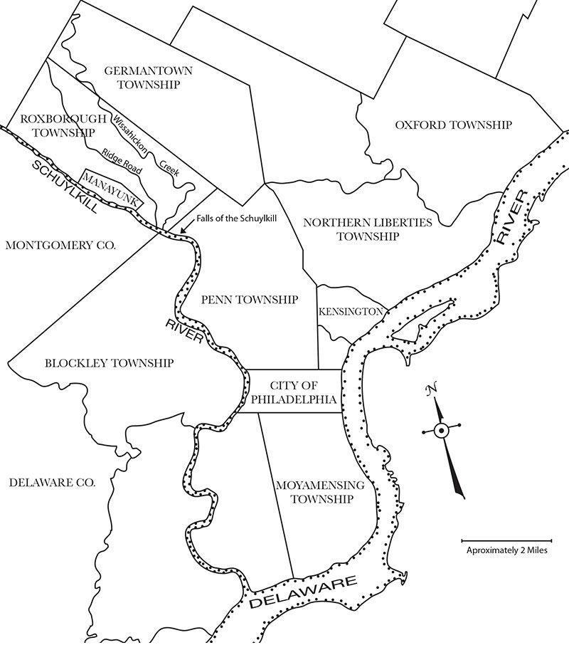
Ben Franklin Parkway
Our trip begins by leaving the hotel and making our way to the Ben Franklin Parkway. It may appear to have been built into the original plan for Philadelphia, but it was not part of Penn’s Plan and is a great example of what is referred to as the “City Beautiful Movement.” The idea for the parkway was first proposed in the late 1800s, but this diagonal one-mile stretch cutting across Penn’s grid was not executed until 1917. The parkway was designed by Jaques Greber and Paul Cret to open up a grand entrance way to Philadelphia and was influenced by the Champs-Élysées in Paris. The parkway is a large footprint and was accomplished by tearing down an area of industry, warehousing, and modest housing. The buildings you see were all built after the completion of the parkway and the area is dominated by museums and landscaping. Recently much effort has been put into making the parkway more pedestrian friendly. Figure 2 is a set of images that document this part of the trip.
Art Museum
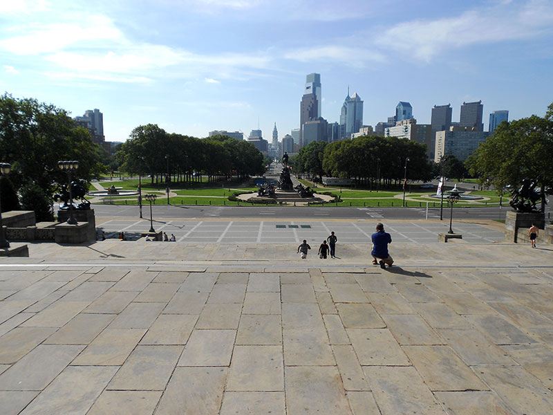
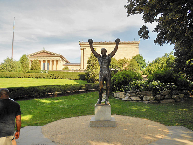
The Art Museum (see Figure 2b and Figure 2c) was designed by architects Shay and Abele and completed in 1928. It is one of the largest museums in the U.S. and attracts 800,000 visitors a year. The steps are famous in popular culture for the “Rocky” franchise of movies when Sylvester Stallone climbs the steps to rousing music. After Rocky III was filmed Mr. Stallone donated the statue to the Art Museum who turned it down saying, “The statue is not art, it is a movie prop! Remove it please.” For years the statue sat outside the Spectrum Arena in South Philadelphia. In 2006 a compromise put the statue in a grassy area off to the side of the steps. It is popular for tourists to run the steps and then take a photograph with the statue (see Figure 2c).
West Philadelphia, Fairmount Park, and 1876 Centennial Grounds
West Philadelphia was opened for suburban development after the bridging the Schuylkill River with horse cars — and later, electric streetcars — providing access. You can see this reflected in the Italianate, Mansard, and Queen Anne house styles. Lancaster Avenue is an old turnpike that cuts diagonally across the grid that was extended into West Philadelphia which is also part of the Lincoln Highway.
The genesis of Fairmount Park begins with the waterworks and the protection of the water supply coming from the Schuylkill River. Some wealthy Philadelphians started building summer homes outside the city proper for the cooler air and away from yellow fever epidemics. Starting in the 1850s these estates were donated or purchased and pieced together to create one of the largest urban parks in the world spanning over 9000 acres. The bulk of the park straddles the water sheds of the Schuylkill River and Wissahickon Creek, but also includes smaller tributaries. A large segment was developed for the 1876 Centennial Celebration.
The International Exhibition of Arts, Manufactures, and Products of the Soil and Mines, now known as the Centennial Celebration, ran from May to November in 1876. The grounds and most of the buildings were designed to be dismantled after the event. The event was 10 years in planning, but the bulk of the work was done just in time to open a month later than planned. The statistics are staggering: 450 acres, over 200 buildings (five of major size), over 30,000 exhibitors, over ten million visitors (roughly 20 percent of the U.S. population at the time), all enclosed by a three mile fence!
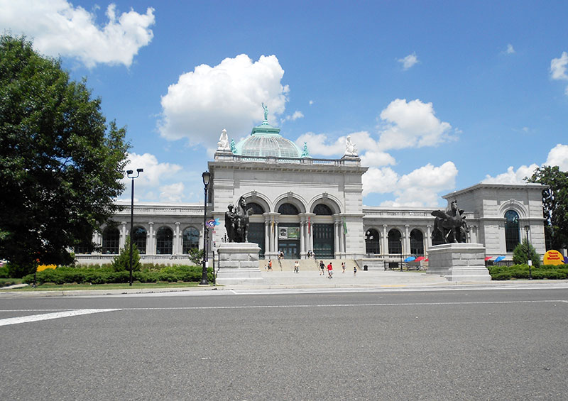
Only two original structures survive. Memorial Hall was designed by Hermann Schwartzmann, who was an engineer and never had designed a building before, to be a permanent building to house the Art Galleries for the exhibition. It is a great early example of beaux-arts architecture. After the exhibition it became the Pennsylvania Museum of Art and its collection was later transferred to the Philadelphia Museum of Art. The Fairmount Park Commission took over in 1958 and converted it into a recreation center. It fell into disrepair and by 1982 it was being used as a police station. In 2005 the Please Touch Museum started an $85 million renovation, opening for business in 2008 (see Figure 3a). A scale model of the fairgrounds is still housed in the building.
The Ohio House (Figure 3b) is the other remaining building that was constructed using many varieties of sandstone from Ohio. After the fair it was in the hands of the Fairmount Park Commission. It was eventually listed on the National Register in 1972 as a contributing structure and was rehabilitated for the Bicentennial Celebration. In 2006 the Fairmount Park Historic Preservation Trust leased the building for adaptive reuse as a café, undergoing extensive restoration in the process, and opening to the public in 2007.
One of the great losses was Horticultural Hall, which was also designed by Schwartzmann to be a permanent structure, and once housed a great botanical collection. It was the largest conservatory at the time and was constructed from iron and multi-colored glass panels to create a large greenhouse completed in a Moorish style. It was surround by 35 acres of landscaped gardens with a large reflecting pool. As the years went by the building attracted fewer visitors and fell into disrepair. It survived a devastating fire in 1931, but the upkeep was expensive, and minor damage during Hurricane Hazel (1954) was used as an excuse to demolish the building in 1955. Its collection was “sown by the wind” to the New York Botanical Garden and Bronx Zoo, with some specimens sold at public auction. The demolition fever was quelled by $200,000 that was raised to save Memorial Hall from the same fate in 1958.
Girard College
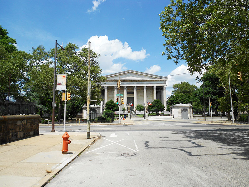
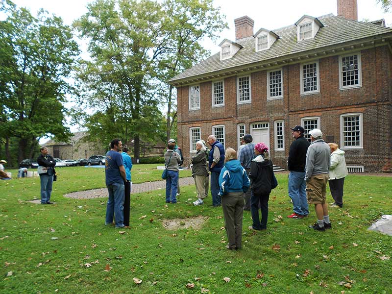
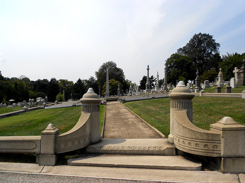
Stephen Girard was born in France and left home at 14 working on a ship and learning the business of trade from the bottom up. He arrived in Philadelphia in 1776 and spent the rest of his life here engaged in shipping and later banking becoming one of the richest men in the U.S. Girard never had children, but most of his wealth was bequeathed to build and operate a school for “poor, white, male orphans.” The school grounds are walled and encompass 27 acres. When Girard College (Figure 4) was constructed in 1833 it was far away from the heart of the city. Founders Hall is a magnificent example of Greek Revival and was designed by Thomas Ustick Walter. Eligible African-American males were not admitted until 1968 after a long battle in the courts. Reverend Martin Luther King, Jr., spoke at the front gates in 1965.
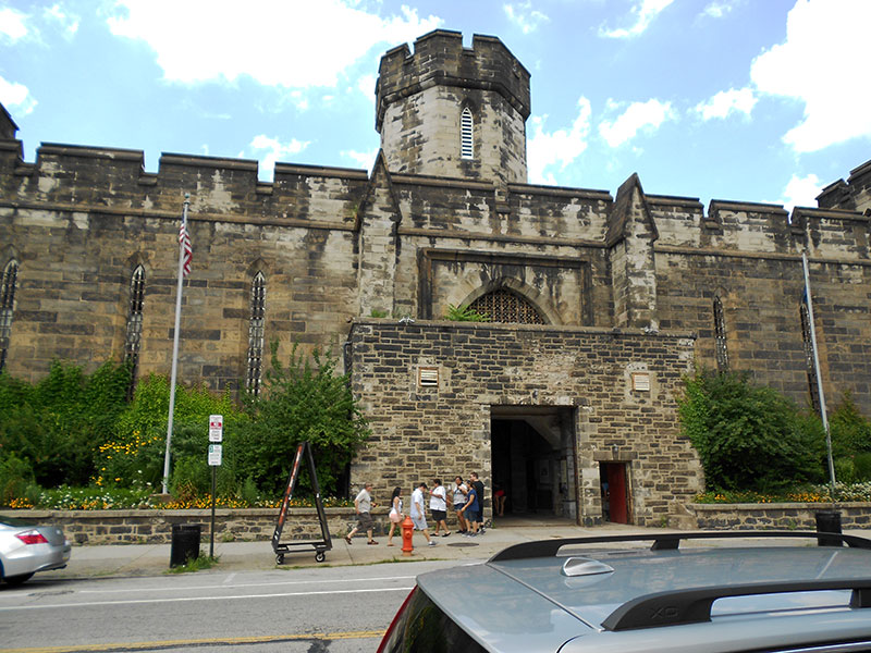
Eastern State Penitentiary and Northern Liberties
Eastern State Penitentiary was started in 1822 and completed in 1829 as a Gothic fortress (Figure 5a). The layout was designed in spokes like a wheel and individual cells with the belief that solitary confinement was the best way to rehabilitate convicts. The design is credited with 300 more prisons built in a similar manner. The prison has a footprint of eleven acres and held some notable prisoners over the years—Willie Sutton and Al Capone, to name just two. The prison operated until 1971 and was then abandoned and left to crumble. The prison is listed as a Federal National Historic Landmark in 1965, but very little is done to preserve it until 1991 with daily tours starting in 1994.
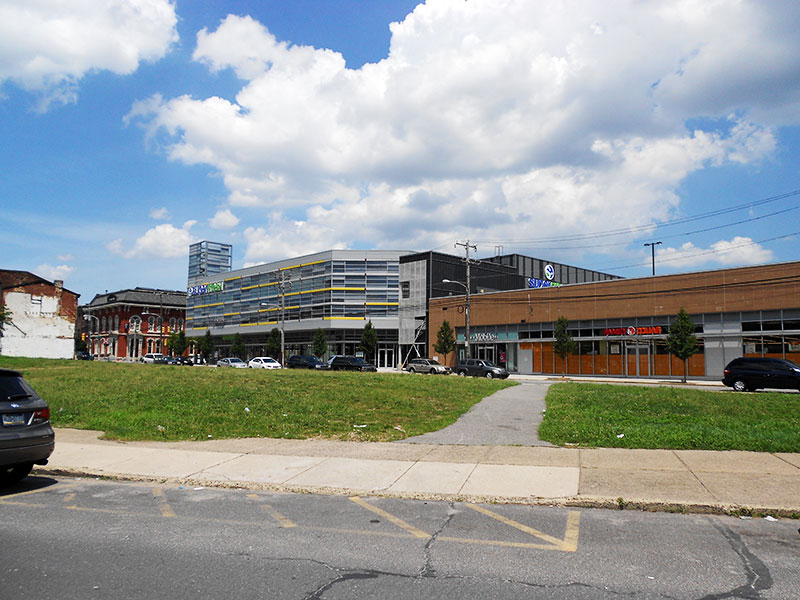
The Northern Liberties section is an old part of the city that developed just north of the original city limits along the Delaware River. This area was gentrifying rapidly before the 2008 crash. Schmidt’s Brewery once occupied fifteen acres here, but when torn down provided much space for new development (Figure 5b). Schmidt’s was started in 1860 and was the last surviving brewery in Philadelphia when it was closed in 1987.
Penn’s Steps and Penn Treaty Park
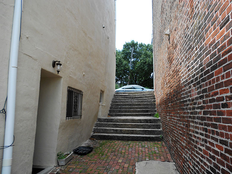
Front Street reveals the remnants of port activities that were so vital to the city’s early history and includes a set of steps (Figure 6a) that were installed by Penn’s order to provide public access to the port. Penn directed that steps like this to be installed all along the water front and these are the only ones that have survived.
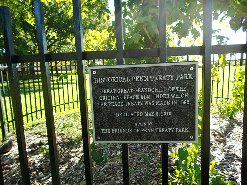
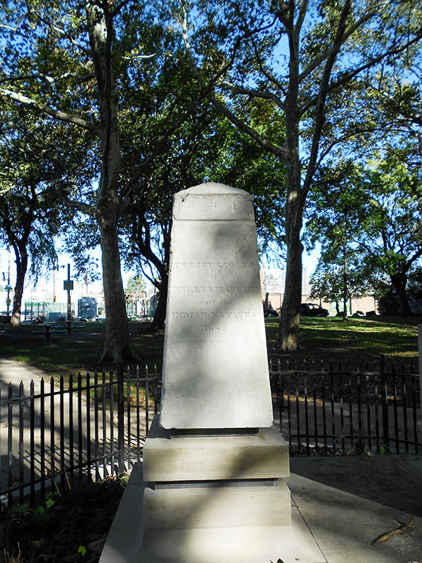
Legend has it that under an elm tree in the Native American village of Shackamaxon, Penn signed a treaty celebrated for never being broken. If this really happened or not will never be known, nor will the exact location if it did occur, but the elm tree was recognized and celebrated as the location for many years until a storm blew down the tree in 1810. Wood from the tree was used to make many souvenirs; one piece ending up as a small box given to Abraham Lincoln. A shoot from the tree was planted in Bay Ridge, NY by the family that owned the tree. It was moved on rail flat cars to another one of the family’s estates to Wilkes-Barre in 1887. Over time shoots from this tree and also later generations were planted in other locations including here in the park (Figure 6b). The myth of this event and location is so powerful that the statue of Penn on top of City Hall faces this location. The tree ends is prominent in Edward Hick’s famous painting “Peaceable Kingdom” completed 40 (1848) years after the tree was gone. Penn Treaty Park was established and became part of Fairmount Park in 1894. The obelisk commemorating the location (Figure 6c) was erected in 1827.
Fishtown
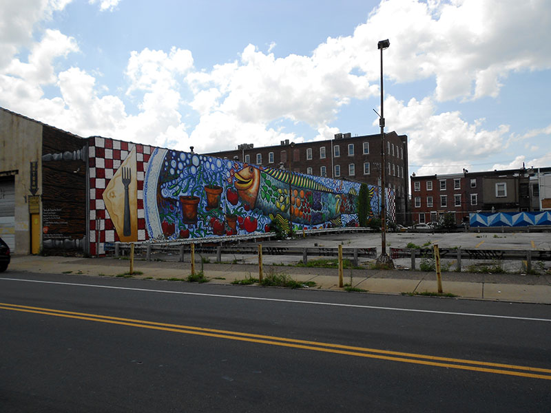
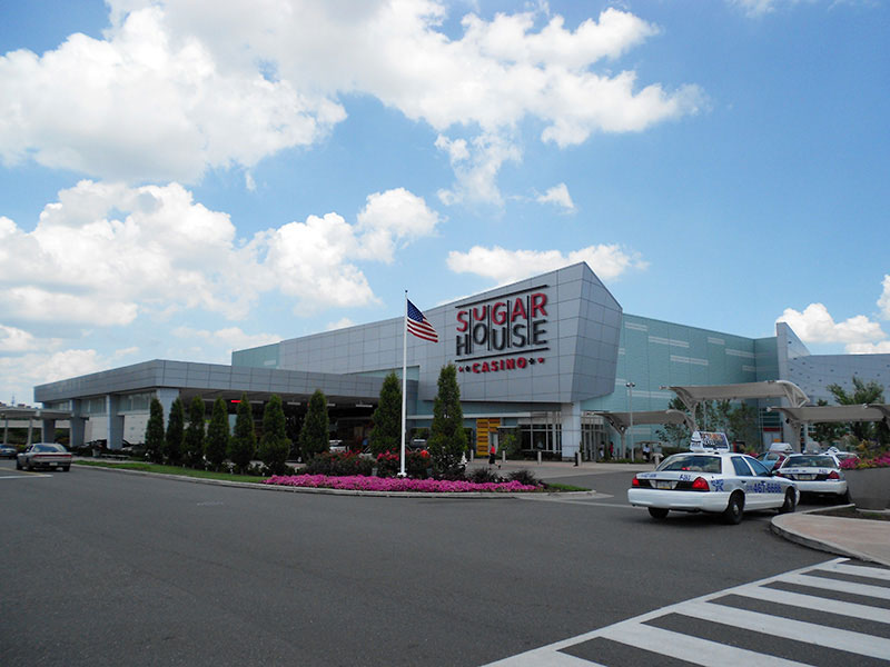
Legend says that Fishtown was named by a visiting Charles Dickens, but it was actually named for the seemingly inexhaustible shad that migrated up the Delaware River. The shad proved to be exhaustible, but the name stuck (Figure 7a). After a long absence enough shad have returned to hold festival every April where more beer is consumed than shad eaten. When the shad ran out the river front became devoted to ports (especially coal exports), ship building and other industries. The Sugar House Casino (Figure 7b) was named after a large complex that once refined Jack Frost brand sugar that ceased operations in 1984 and was demolished in 1997. The neighborhood filled in over a long period so you have architectural styles that reflect that including trinity (band-box) row houses, federal period, romantic, and Victorian elements. Recent gentrification has added some interesting contemporary house structures to the mix. This neighborhood felt the effect of the federal bulldozer when I-95 was constructed in 1985 which effectively “fileted” Fishtown.
Palmer Cemetery
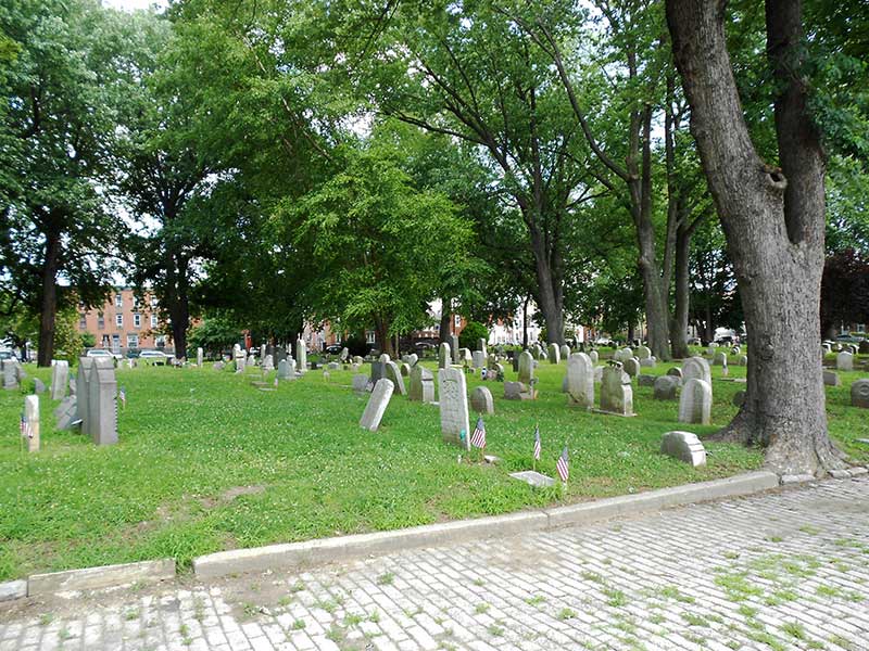
The sign says 1732, but the historic record documents 1765 as when Palmer Cemetery was officially established. A survey of land in 1750 indicates that this area was already being used as a burial ground, but for how long is unclear; thus the sign. What is clear is that Palmer Cemetery (Figure 7c) holds veterans of most of the wars, a multitude of victims of the yellow fever epidemics (169 for the 1793 episode that killed about ten percent of Philadelphia’s population), and continues to take in local residents and is considered one of the oldest free community cemeteries in the country. Anyone that lives within the borders of Fishtown can claim a spot by driving poles into the ground and hitting no obstacles.
North Philadelphia
Along Broad Street there are remnants of the great mansions that were built along this major thoroughfare. Temple University has recently brought significant changes to the surrounding neighborhood due to increasing enrollments and students who want to live in an urban setting. When Temple was established (1884) this was a prosperous neighborhood, but it declined with the closing of the nearby factories. The Temple on Broad Street, adaptively reused as a preforming arts center, was recognized with a certificate of merit for historic preservation by PAS:APAL. On Germantown Avenue is Fair Hill Cemetery that was started in 1843 near a Quaker Meeting House (1703). When it was established it was at the far-edge of urban development, but eventually it became an island in a densely developed area. It is the resting grounds of many who were involved in the Underground Railroad including feminist and abolitionist Lucretia Mott and abolitionist Robert Purvis. With the decline of the neighborhood the site became a trash strewn (even abandoned cars) weedy lot that was used by drug dealers and users. The neighborhood decided to take back this treasure and cleaned it up and it was listed on the National Register in 1998.
James Logan and Stenton
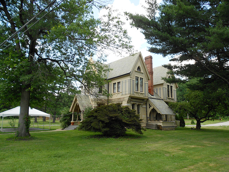
William Penn was not known for his good judgment of people, but he chose well for his assistant with James Logan. He met Logan in Bristol working as a teacher. By the time (1701) Logan came to Pennsylvania to be Penn’s representative he had command of five languages (beyond English): Latin, Greek, Hebrew, French, and Italian (And later in life he added Arabic, Persian, and Syriac). He was also a brilliant mathematician, not only having the only copy of Newton’s Principia Mathematica in the New World, but most likely the only one who understood it. Logan was a Renaissance man who also dabbled in botany and able to decipher how the maize plant is pollenated. His private library held 2500 books which are still held by the Library Company of Philadelphia. He proved to be a great manager of Pennsylvania and he became a wealthy man in the process. Logan was one of the first in Philadelphia to use his wealth to build an estate in the country so he could have some peace and quiet to pursue his intellectual interests. He called the estate Stenton, named for his father’s birthplace. Stenton was completed in 1730 and is considered the first of the Queen Anne Style built in the region. The estate has been reduced to a six-acre oasis in what became a densely developed industrial area. The buildings, grounds, and barn have been preserved (see Figure 8).
Germantown Avenue
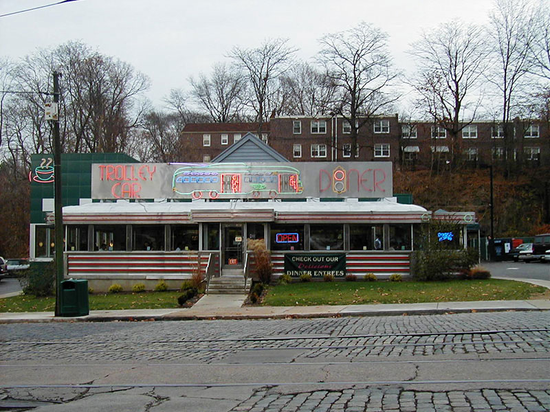
A plethora of historic buildings and sites can be found along Germantown Avenue with architectural styles that cover the colonial to the contemporary. In the Chestnut Hill business district a concerted effort was taken in the 1950s and 1960s to ‘colonialize’ everything, so you will see pent roofs added to Spanish Revival buildings. A transplanted modern structure (Figure 9) was added which is covered in PAS member Kevin Patrick’s Diners of Pennsylvania book and it now called the Trolley Car Diner (previously the Joe Palooka Diner in Wilkes-Barre). The tracks and wires are still in place along Germantown Avenue, but the trolley has not run since 1992 on what was the longest route in the city.
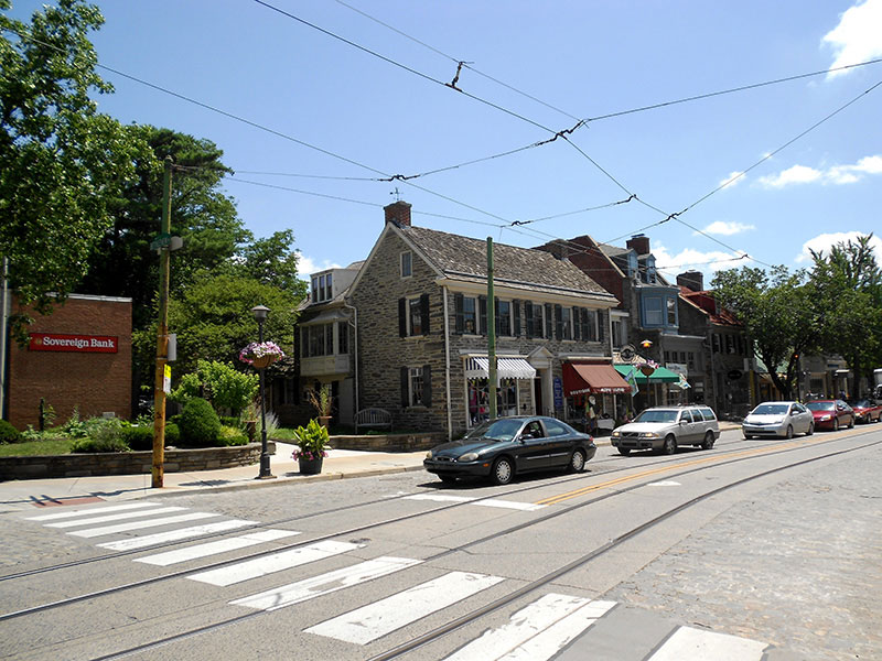
Chestnut Hill
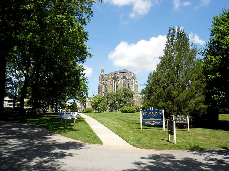
Chestnut Hill is a good description for this early example of a railroad suburb; it is the highest point in Philadelphia and it still has a great deal of tree coverage. Chestnut Hill first started as a crossroads village created in the early 1700s where Bethlehem and Germantown Pikes met. Both roads were extended and improved in the early 19th century as turnpikes and became the lifeline for this gateway village. You can see this reflected in an I-House that is now used for business (Figure 10a. Several roads were built perpendicular to Germantown Pike to allow access to the grist mills along the Wissahickon Creek. There was limited development beyond farming until the railroad.
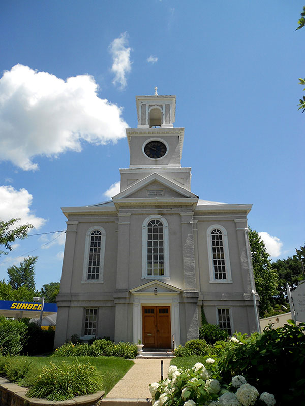
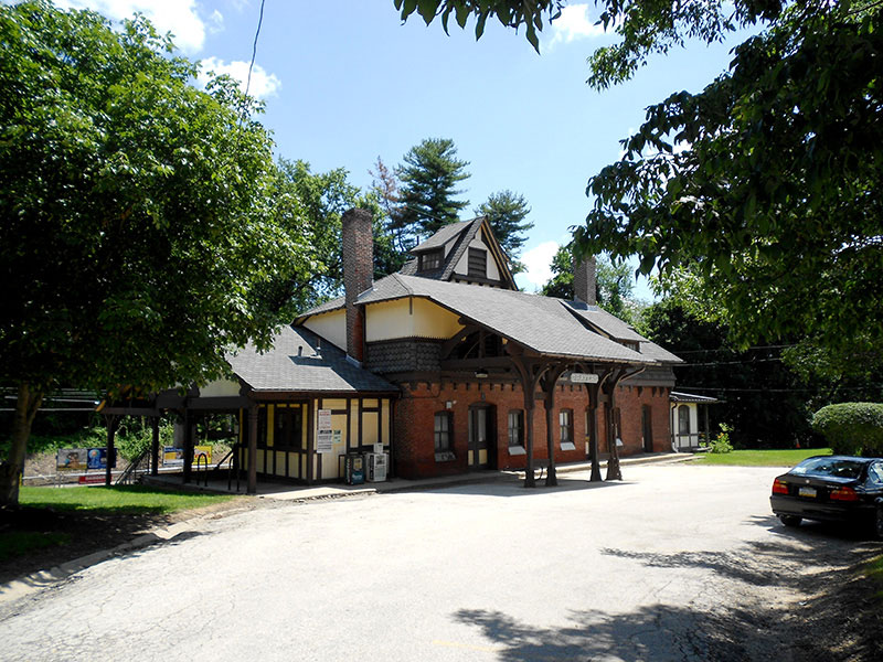
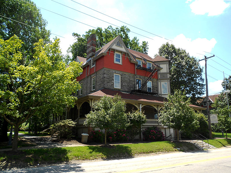
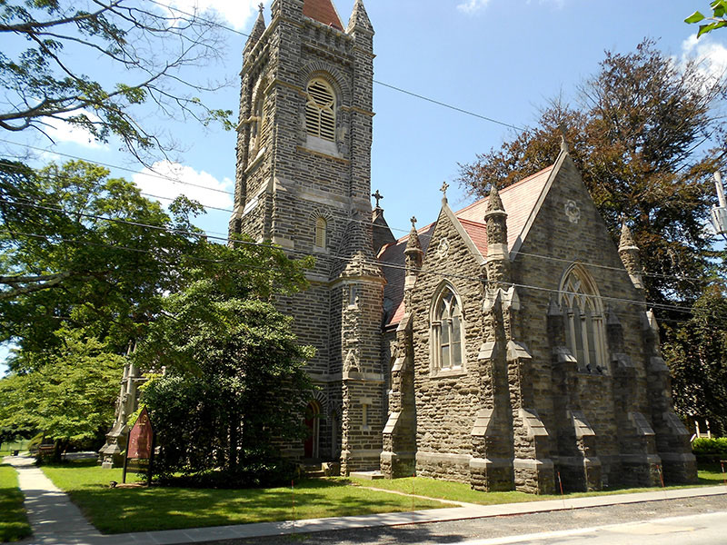
The Reading Railroad built a line to Germantown in 1832 and extended it to the East Side of Chestnut Hill in 1854. This allowed wealthy people to live in the cooler and greener areas outside the city and still maintain the amenities of the city a short train ride away. You can still see the homes built near the train station in the Gothic, Italianate (Figure 10b), and Mansard styles popular at the time. Figure 10c shows one of the early churches in Chestnut Hill. The Gravers Lane Station (Figure 10d) was designed by Frank Furness and built in 1883. It was listed on the National Register in 1977 and was restored in 1981. The water tower (Figure 10e) was built in 1859 to distribute public water to the area. It was supplied by a reservoir where a recreational center stands now.
Henry Houston and the West Side
Henry Howard Houston was a leading Philadelphia businessman and philanthropist who made his wealth as one of the important men at the Pennsylvania Railroad (PRR). Houston was instrumental in building the Philadelphia, Germantown, and Chestnut Hill branch of the PRR in the early 1880s which was in direct competition with the less powerful Reading Railroad (RRR) that was built earlier to this area. This became a successful venture for both the PRR and Houston who had purchased large tracts of farmland in Chestnut Hill prior to the building of the line and stations in 1882.
Houston built and established amenities to attract his upper-class cronies to move to Chestnut Hill. A large resort hotel (see Figure 11a) was built in 1884 with 250 rooms to bring in summer vacationers and potential full-time residents. The hotel was not used for long and now forms the core of the Chestnut Hill Academy. From 1892 to 1908 a large and exclusive horse show was held that eventually moved and has become the well-known Devon Horse Show. The Philadelphia Cricket Club was established in 1854 when the Anglo centric wealthy took to the game that was brought to America by immigrant English hosiery workers. Houston provided a permanent home in 1884 in a Queen Anne structure that was replaced by the current colonial revival building after a fire in 1909. Houston then added at his own expense the Saint Martin-in-the-Fields Episcopal Church in 1889 (see Figure 11b). The church, like most of the buildings mentioned above, was designed the Hewitt brothers, both of whom had worked with Frank Furness and went on to become distinguished architects on their own.
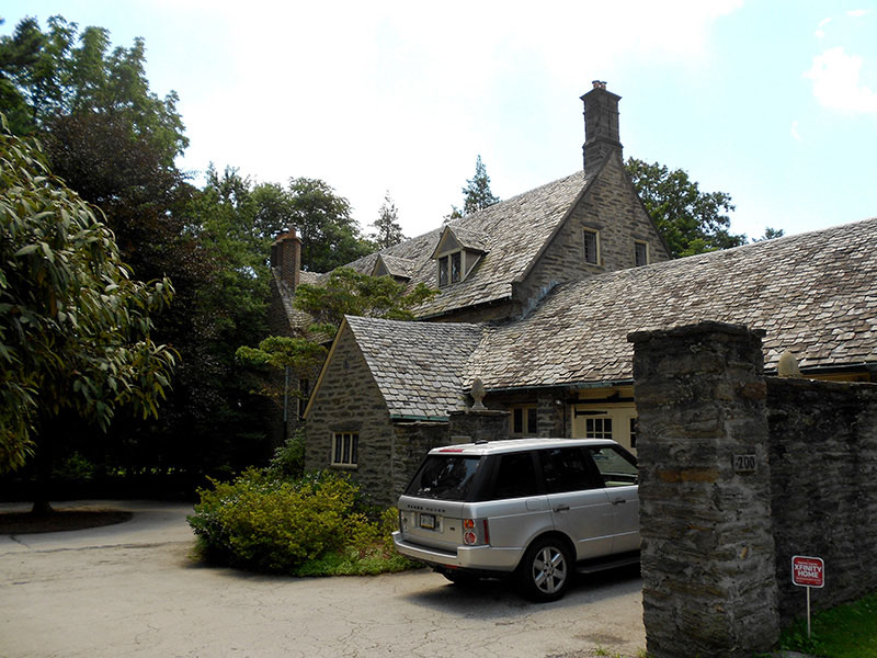
Houston also built large Queen Anne Style houses (Figure 11c). He rented the houses out to hand-picked wealthy folks like himself, only selling occasionally so that he (and later the estate) could keep control of who lived in this exclusive suburb. This power extended to changing the names of the typically numbered streets to Native American names (Navajo). Houston eventually completed his large mansion/castle in 1886 calling it Druim Moir (great ridge). It is surrounded by 52 acres of lawn, gardens (ornamental and agricultural), deer park, livestock pens, woodlots, and two large greenhouses to supply flowers year-round. The front of the estate is now occupied by a private school and the house is not accessible to the public.
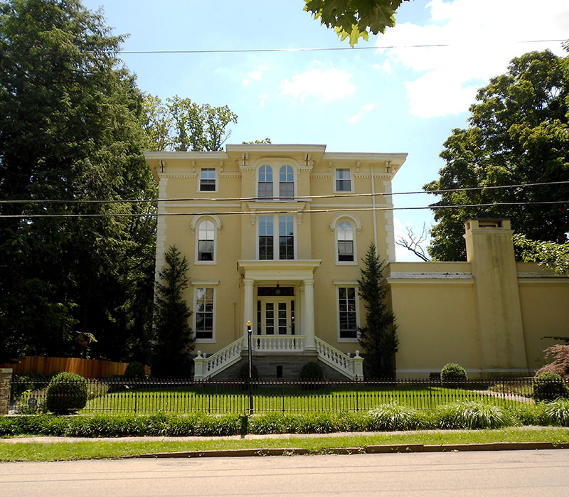
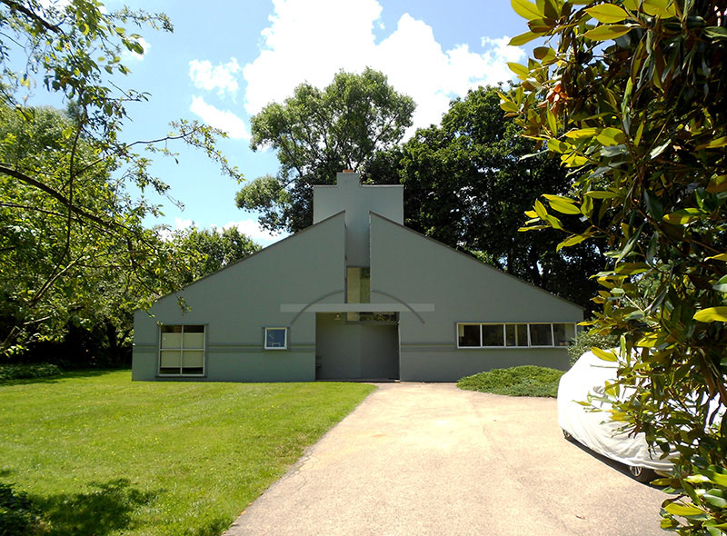
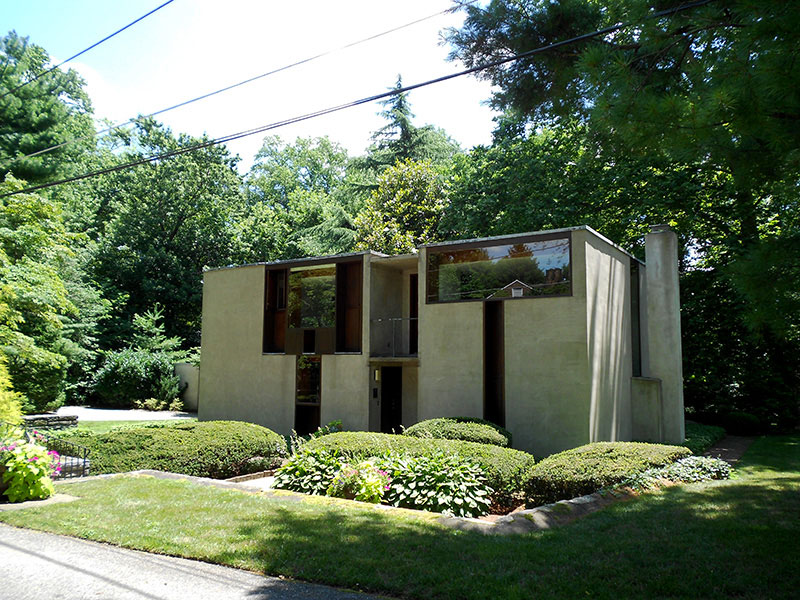
After Houston’s death (1895) his daughter (Gertrude) and son-in-law George Woodward built their own mansion and also continued the tradition of building rental housing, but designed in eclectic styles for more modest incomes. By 1920 he set aside land for Pastorius Park and had completed 180 houses. The area around the park later attracted several modern and famous Philadelphia architects to build houses there. Robert Venturi built a house for his mother in 1964 (Figure 11d). Louis Kahn designed a house (Figure 11e) for Margaret Esherick which was completed in 1961. Another project funded by Woodward near Pastorius Park is a replica of Sulgrave Manor, the ancestral English home of George Washington. A replica was built for the 1926 Sesquicentennial celebration in Philadelphia and proved to be a big draw. Woodward bought the interiors and had one of own architects (H. Lewis Duhring Jr.) design and build a replica (Figure 11f)
Ridge Avenue
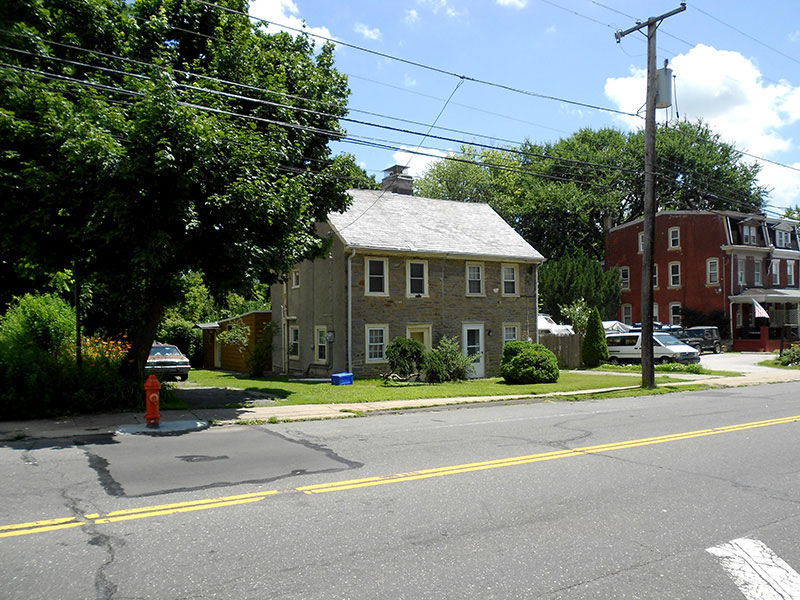
Ridge Avenue follows the Native-American Perkiomen Trail that originates in Shackamaxon Village on the Delaware River (Fishtown) and trends northwest to Reading. The road was established as a turnpike in 1706 the name comes from the part of the road that straddles the ridge between the Wissahickon Creek and Schuylkill River in Roxborough (see Figure 1). One of the earliest surviving structures has been dated to 1716 (Figure 12a) Ridge Avenue also has many examples from the 19th and 20th century architectural styles mixed in. Many of the older cross roads (Wise Mill, Lizvey, etc.) were established to transport grain grown on top of the hill to the early grist mills established along the Wissahickon Creek and are named after the mill owners.
Soon after his successful venture in Chestnut Hill, Houston decided to develop the second highest point in the city. The Andorra Section, named for, but not quite as picturesque as the Pyrenees, was the site of his next project. He first bought most of the farmland and then proceeded to make plans to build a branch of the PRR to this area planning to create another exclusive neighborhood like he did in Chestnut Hill. The economic depression in 1893, along with the realization that the railroads were over-extended financially, ended these dreams. Houston died in 1895 leaving his real estate operations to his family. With no direct railroad connection this area remained mostly open land. Over the years several interesting schemes were proposed to get a return on their investment.
After the great success of the 1876 Centennial celebration Philadelphia was eager to host the 1926 Sesquicentennial Celebration. The agents of the Houston Family proposed using their land in Andorra and some exotic ideas were proposed including an almost mile-long escalator to bring visitors from boats plying the Schuylkill up the hill to the fairgrounds. It appears that the development costs scared away the planning committee and the fairgrounds ended up in a reclaimed swamp in South Philadelphia.
In 1926 102 acres of the Houston Estate were purchased by the Episcopal Diocese of Pennsylvania with plans to build the largest cathedral in the world. In the end only the apse and a small side chapel were ever completed (Figure 12b). By the time the depression and WWII are over the enthusiasm dimmed and the plans abandoned. The apse and side chapel continues to be used for services, but the grounds around it were used to build a retirement community.
In an interesting, but little known part of history, Philadelphia was seriously considered to be the permanent headquarters for the United Nations. Once it was determined that it could not be done near Independence Hall, Andorra was proposed and was favored by half of the location selection committee. Only a last minute offer by J.D. Rockefeller of a parcel of land along the East River sealed the deal to bring it to New York City.
The Houston Estate eventually developed the land in the 1950s with post-World War II suburban style housing and a shopping center. Other parcels have been used for more utilitarian purposes like reservoirs and large antennas that would never have been tolerated in Chestnut Hill.
Water-Works
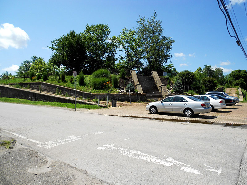
Roxborough is the second highest elevation in the city thus making it a great location to distribute water and later to build radio and TV transmission towers. The reservoirs (Figure 12c) date to 1892 and were in use until the early 1960s. Nature has reclaimed them since creating a wetland area on top of a hill. Over the years this 34 acre site has tempted developers; serious consideration was even given to building the NFL Eagles’ practice facility here. In order to preserve this area as open space the Upper Roxborough Civic Association was able to get the neighborhood listed on the National Register in 2001 and expanded it in 2004 to include the reservoirs. The pumping station complex at the bottom of the hill along the river was demolished in 2011.
Manayunk
For a full discussion on Manayunk please refer to a recent article I wrote for PAST (2012). The name Manayunk was created from a Lenape Indian term for this location along the river that meant “place where we drink” A canal was completed in 1819 that created a sliver of land between the canal and river which soon became crowded with textile mills that were built to take advantage of the water power available along with other industries (paper mills and soap factories). When steam engines improved the mills were no longer tethered to the canal and so you can find mills scattered throughout this neighborhood. You can also find many small two-story structures that housed the workers. Manayunk thrived as an industrial center, but a slow, steady decline took place in the 20th century and by 1960 most of the industry was gone, but not the residents. The once-thriving business district was mostly abandoned by 1960.
It was common knowledge in the early 1980s that gentrification was going to happen, but it did not proceed quickly. There were weak signals that changes were underway in the 1970s, a few antique stores had opened and closed, but not much else that would indicate a major change was coming. Until the mid-1980s Main Street was still dominated by vacant business, building supply firms, and a handful of surviving bars and sandwich shops that catered to locals. The business district may have been mostly abandoned, but the residential areas were still predominantly occupied by long-time residents. There was no significant influx of artists or other “pioneers” until much later in the gentrification process.
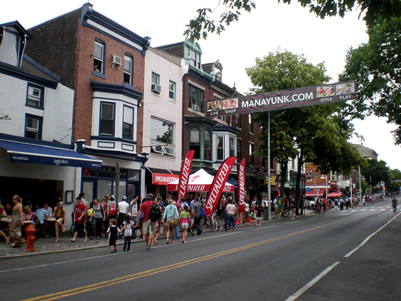
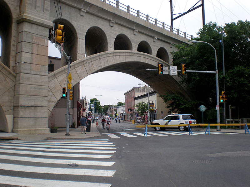
The buildings on and near Main Street are turn-of-the-century Italianate and Queen Anne styles, constructed of brick and local stone, and for the most part unaltered (Figure 13a). The changing whims of taste did not get a chance to alter the integrity of the buildings; they were like a time capsule of the past. Along with the architectural charm was an urban landscape built on a human scale of mostly two to three stories that already had a history of businesses at the street level with apartments above. Main Street was designated as a historic district in 1984. The entrance to Manayunk is framed by a railroad bridge (Figure 13b).
By the 2000s the number of long-time residents was declining and newer residents were moving in. The U.S. census shows long-term residents being replaced by renters. The escalating price of homes have attracted outside investors who have bought properties and converted them to rentals. Another main driver of this change was a government policy; a ten year tax abatement for new or significantly remodeled (loft apartments in old industrial buildings) structures. The long-term residents and any interested “pioneers” could not compete well with outside investors and their resources. Housing prices escalated significantly up until the 2008 housing bubble.
“I see dead people”
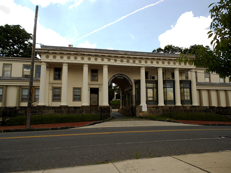
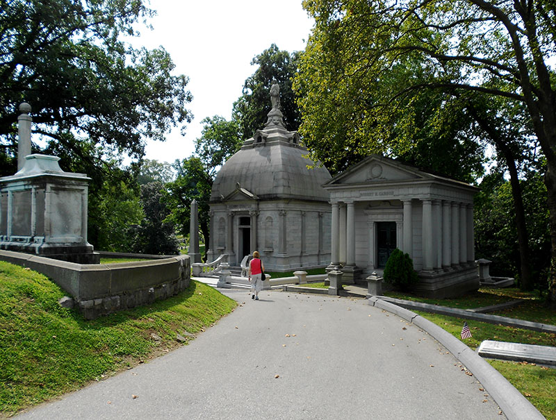
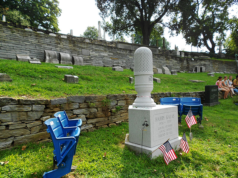
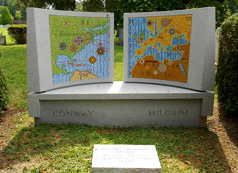
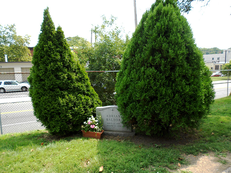
Laurel Hill is one of the great cemeteries in the U.S. and the first to be designated as a National Historic Landmark (1998). It was established in 1836 and the designers set out to make sure it would be a tranquil and picturesque location along the banks of the Schuylkill River far away from the city. In a time when most people were buried in churchyards, Laurel Hill was something very different, a non-sectarian cemetery in a garden-like setting, created in the mold of Mount Auburn Cemetery (1831) in Cambridge, Massachusetts. It was a place designed for both the dead and living with 30,000 visitors in 1848. Laurel Hill expanded to 78 acres and is the resting place of many famous Philadelphia citizens. Rocky Balboa’s fictional wife Adrian is also fictionally buried here; another movie prop. See Figures 14 for a set of images from the cemetery. (Figure 14a, Figure 14b, Figure 14c, Figure 14d, Figure 14e, and Figure 14f.)
All Aboard the Coltrane
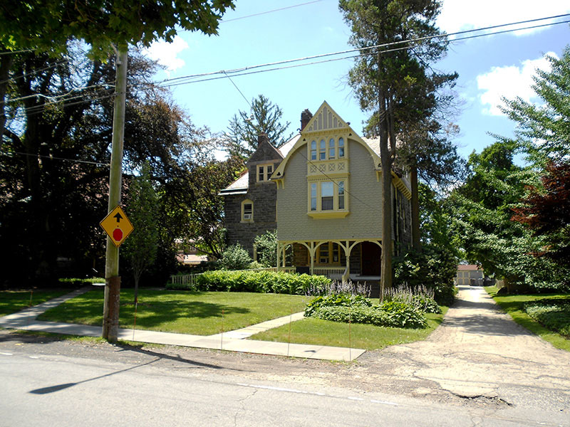
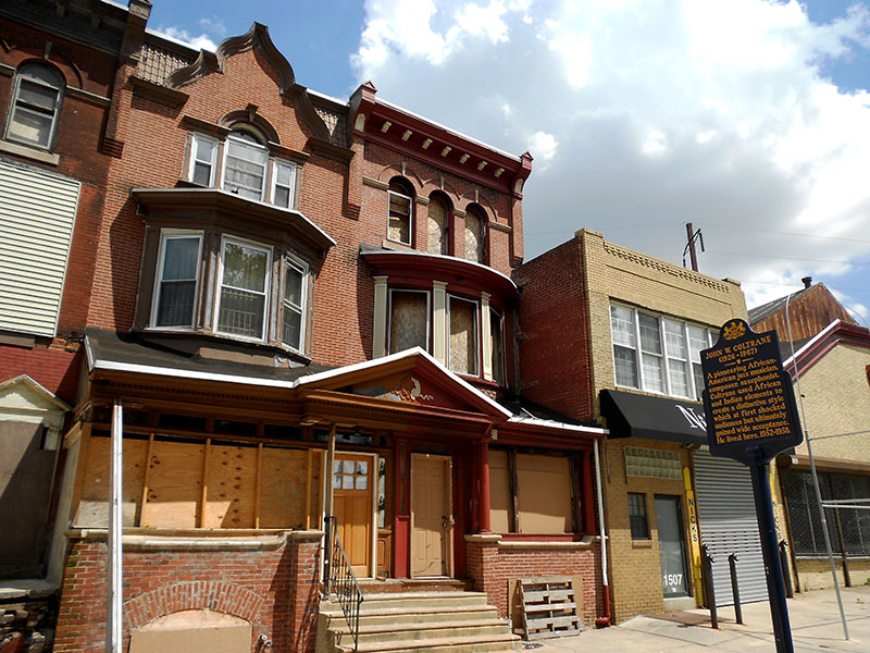
The great jazz saxophonist and composer John Coltrane lived in Philadelphia during his formative years from 1942 to 1958. In 1952 he bought the Victorian house (Figure 15, ) on North 33rd Street for himself and extended family. In 1958 he moved to New York, but his mother continued to live in the house until her death (1977) and then his cousin Mary (for whom he named a song) acquired the house. In 2004 it was sold to a dedicated fan with plans to restore the house. It was designated as a National Historical Landmark in 1999 and the current owner has set up a non-profit to continue the restoration.
Sources
Books and Journals:
Anderson, Elijah. 1999 The Code of the Street. W. W. Norton and Company, New York.
Contosta, David. 1992 Suburb in the City; Chestnut Hill Philadelphia, 1850-1990. Ohio State University Press, Columbus, Ohio.
Conzen, Michael (editor). 2010. The Making of the American Landscape Second Edition. Routledge Press.
Del Collo, Deborah. 2011. Roxborough. Arcadia, Charleston, SC.
Dougherty, Percy (editor). 2004. Geography of the Philadelphia Region: Cradle of Democracy. AAG, Washington DC.
Fisher, G.A. 2006. “The Gentrification of Manayunk” Masters Thesis, University of Pennsylvania.
Jacobs, J. 1961. The Death and Life of Great American Cities. New York: Random House.
Keels, Thomas. 2007. Forgotten Philadelphia: Lost Architecture of the Quaker City. Temple University Press, Philadelphia, PA.
Keels, Thomas and Jarvis, Elizabeth. 2002. Chestnut Hill. Arcadia Publishing, Charleston, SC.
Lynch, K. 1960. The Image of the City. Cambridge MA: Massachusetts Institute of Technology Press.
Milano, Kenneth. 2011. Palmer Cemetery and the Historic Burial Grounds of Kensington and Fishtown. The History Press
Milano, Kenneth. 2009. The History of Penn Treaty Park. The History Press.
Sanders, R. 2002. “Philadelphia’s Neighborhoods: A Social Geography of Manayunk and Manayunkers” In P. Rees editor Philadelphia: Transforming Tradition in the 21st Century. Philadelphia, PA: Prepared for the Joint Meeting of the National Council for Geographic Education and the Pennsylvania Geographical Society, 76 – 85.
Shank, W. H. 1960. The Amazing Pennsylvania Canals. York, PA:American Canal and Transportation Center.
Shelton, C. J. 1986. The Mills of Manayunk; Industrialization and Social Conflict in the Philadelphia Region, 1787 – 1837. Baltimore, MD: The Johns Hopkins University Press.
Elton Atwater. 1976. The Pennsylvania Magazine of History and Biography Vol. 100, No. 2 (April), 243-257.
Wallace, Paul. 1965. Indian Paths of Pennsylvania. The Pennsylvania Historical and Museum Commission, Harrisburg, PA.
Weigley, Russell (Editor). 1982. Philadelphia: A 300- Year History. W.W. Norton, New York.
Web Sources:
U.S. History – Benjamin Franklin Parkway: Last accessed July 8, 2013.
http://www.ushistory.org/franklin/philadelphia/parkway.htm
St. Mary’s Church Cathedral Road History: Last accessed July 8, 2013.
http://stmaryscathedralroad.org/st-marys-history/
Philadelphia Museum of Art: Last accessed July 8, 2013.
http://www.philamuseum.org/information/45-19.html
Fairmount Park Historic Preservation Trust: Last accessed July 8, 2013.
http://www.fairmountparktrust.org/lp-ohiohouse.php
Eastern State Penitentiary: Last accessed July 8, 2013.
http://www.easternstate.org/learn/timeline
The John Coltrane House: Last accessed July 8, 2013.
http://www.johncoltranehouse.org/
Laurel Hill Cemetery: Last accessed July 8, 2013.
http://www.thelaurelhillcemetery.org/index.php?m=1&p=1&s=1
Philadelphia Water Department – Adam Levine: Last accessed July 8, 2013.
http://www.phillywatersheds.org/watershed-history-roxborough-water-works
Friends of Penn Treaty Park – Park History: Last accessed July 8, 2013.
http://penntreatypark.org/penn-treaty-park/history/
Plan Philly – Paying Homage to a Great Tree: Last accessed July 8, 2013.
http://planphilly.com/paying-homage-great-tree
Growing History – The Philadelphia Historic Plants Consortium: Last accessed July 8, 2013.
http://growinghistory.wordpress.com/2012/02/28/some-history-of-historic-plants/
Workshop of the World – Fishtown – Jack Frost Sugar: Last accessed July 8, 2013.
http://www.workshopoftheworld.com/fishtown/frost.html
Author Biography
Wayne Brew is an Assistant Professor of Geography at Montgomery County Community College who teaches introductory courses in Cultural, Physical, World Regional, and Urban Geography. When not busy teaching his research is focused on historical geography including vernacular structures (houses and roadside commercial architecture), remnants of transportation infrastructure (canals, rail, and auto), and cultural landscapes. He has Bachelor of Science degrees in Earth Science (Geology Concentration) and Geography from the Pennsylvania State University and a Master’s degree in Geography from Temple University.